

Table of Contents
Some links on posts are affiliate links and will earn us a commission from qualifying purchases
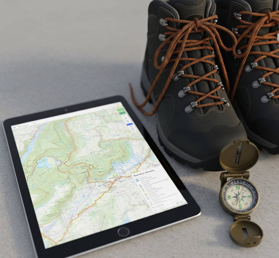
Planning a great hike means having the right tools. The best apps combine maps, route details, weather forecasts, and safety features to make your trip easier and safer. They help you find trails, plan your route, and prepare for whatever comes your way.
With so many apps out there, it’s tough to pick the best ones. You need tools that offer offline maps, emergency alerts, and detailed trail info, especially for remote areas. Choosing reliable apps lets you enjoy nature without constant worry. Using these tools means less time stressing and more time exploring.
Top Hiking Apps
These apps help you find routes, track your progress, and prepare for various trail conditions. They offer detailed maps and planning features, often with offline use or terrain info to keep you safe and organized.
- AllTrails AllTrails is a popular choice with over 100,000 trails worldwide. You can search by difficulty, length, and user ratings to find the perfect hike for you. It offers detailed maps, elevation profiles, and user reviews. You can also download maps for offline use, which is key when you don’t have phone service. AllTrails also lets you create custom routes, track your hike with GPS, and share your experiences.
- Komoot Komoot focuses on detailed route planning and turn-by-turn directions. It uses topographic maps that show elevation and surface types, helping you prepare for climbs or tricky paths. You can customize routes for hiking or cycling, access maps offline, and even export routes to GPS devices. Plus, its community features let you find local tips and share your adventures.
- Gaia GPS Gaia GPS is for serious hikers who need detailed maps and advanced navigation. It offers topographic, satellite, and terrain maps with layers showing trails, landmarks, and land boundaries. This helps with detailed planning for remote or less-marked trails. You can download large areas for offline use, customize maps with waypoints, and track hikes with GPS. It also supports weather forecasts and backcountry alerts, which is great for longer treks.
Navigation and Mapping Tools
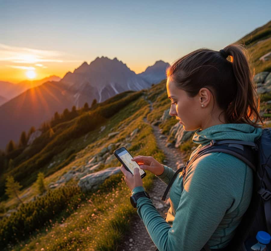
You need reliable maps and navigation that work offline and guide you clearly. Good apps offer detailed maps, GPS tracking, and easy ways to plan routes before you start hiking. Look for tools that let you download maps, track your location, and keep you safe with emergency features.
OS Maps OS Maps brings the well-known Ordnance Survey maps to your phone, giving you detailed views across the UK. You can download maps for offline use, which is essential when you’re out of signal. It includes route planning, GPS tracking, and waypoint marking. This tool is trusted for accurate info on paths, contours, and natural features.
MapMyHike MapMyHike tracks your walk with real-time GPS data like distance, elevation, and speed. It’s easy to use for recording hikes and sharing routes. While great for fitness tracking, it also offers solid basic navigation for shorter hikes. Maps can be viewed online, but offline options are limited.
Avenza Maps Avenza Maps specializes in offline map use, letting you download detailed maps from professionals or other users worldwide. You can track your location with GPS even without phone service, making it great for remote areas. It supports many map types and lets you import your own custom maps.
Route Planning and Itinerary Apps
These apps help you design your hiking routes clearly and efficiently. They let you map out trips, track progress, and access detailed trail data, saving you time with pre-planned routes and customizable options.
Outdooractive Outdooractive offers many features for route planning. You can create, edit, and save routes easily, with access to detailed topographic maps. It includes elevation profiles and distance calculations to help you understand your hike’s difficulty. You can import routes from others or design your own, and offline map downloads are available.
ViewRanger ViewRanger is known for its easy-to-use interface and reliable GPS tracking. It has a large database of crowd-sourced trails and official maps for accurate planning. You get real-time navigation, reducing the risk of getting lost. With ViewRanger, you can access offline maps, and its “Skyline” feature uses augmented reality to identify peaks and landmarks.
Wikiloc Wikiloc hosts millions of user-submitted routes globally. It’s perfect if you want to explore hikes created by other outdoor enthusiasts. You can download trails for offline use and follow GPS navigation. Wikiloc also provides detailed descriptions, photos, and user ratings to help you choose safe and enjoyable options.
Weather Forecasting Tools
Accurate weather info is crucial for safe hiking. The right app gives detailed forecasts, shows weather changes, and helps you decide what gear to bring.
Met Office Weather Met Office Weather is Britain’s national weather service, offering reliable data for UK hiking. You get detailed forecasts for specific areas, including mountain weather warnings and hourly updates. It provides temperature, wind speed, and rain chances in an easy-to-read format. Alerts for severe weather help you decide whether to adjust your plans.
Windy Windy is popular for its detailed weather maps and visual forecasts. It uses data from multiple sources to show wind, rain, temperature, and cloud forecasts on interactive maps. It’s great for hikers because you can zoom in on specific trails and track wind speed and direction, important for exposed areas.
YR.no YR.no is a free Norwegian weather service providing detailed and reliable global forecasts. It offers clear data like precipitation, wind speed, temperature, and cloud cover. YR.no focuses on simplicity with accurate hourly and daily forecasts, making it easy to plan your day.
Offline Maps and Emergency Apps
When hiking, having maps without internet and ways to signal for help can be lifesaving. Some tools focus on detailed offline navigation, while others provide precise location sharing for emergencies. Using these apps greatly improves your safety and confidence on the trail.
OS Locate OS Locate, from Ordnance Survey, shows your exact grid reference using your phone’s GPS, even without internet. This helps you share your precise location with rescuers or friends if you get lost. It works offline and uses the trusted OS grid system common in the UK.
What3words What3words divides the world into 3-meter squares, giving each a unique three-word address. This makes sharing precise locations easy, especially where traditional addresses or GPS coordinates are difficult. You can use it offline to find your exact spot and give these three words to emergency services for quick location pinpointing.
Trail Discovery and Community Platforms
Finding the right trails and connecting with other hikers can greatly improve your planning and experience. Some apps offer detailed trail info, user reviews, and maps, while others provide tools to explore routes with clear, easy-to-use interfaces.
Hiking Project Hiking Project is excellent for discovering trails with detailed maps and descriptions. It has thousands of user-shared and reviewed routes, showing difficulty, distance, elevation gain, and key points. It works offline, and you can contribute by adding your own trail reports or photos.
PeakVisor PeakVisor helps you explore mountain trails and identify peaks around you. It uses augmented reality to show peak names and heights just by pointing your phone. It includes 3D maps, trail routes, and detailed mountain data.
Gear Checklist and Trip Preparation Apps
Keeping track of your gear is essential when planning a hike. Apps can help you create and manage packing lists easily.
LighterPack helps you organize gear by weight and category, making it easier to balance your load. The HiiKER app not only helps with packing but also aids trip planning, letting you set reminders for essential tasks.
Using a checklist app saves time and reduces stress. You won’t have to rely on memory or paper notes.
Here’s a simple gear checklist example:
- Essential Gear: Backpack, hiking boots, water bottle, snacks and water
- Clothing: Waterproof jacket, thermal layers, hat and gloves
- Extras: First aid kit, map and compass
Environmental and Safety Tools
When planning a hike, use apps that provide real-time weather updates. This helps you prepare for changes and avoid dangerous situations. Some apps also send alerts about wildlife in the area, keeping you safe and aware. Many hiking apps include SOS or emergency features to notify services if you get lost or injured, crucial in remote locations.
Safety features to consider:
- Weather forecasts tailored to your hiking location
- Wildlife alerts and safety tips
- SOS signaling and emergency contacts
- Offline maps with GPS tracking
Budgeting and Transportation Apps
Managing your budget is important for a hike. Apps like Trail Wallet or Wally let you track expenses for gear, food, and travel. For transportation, Google Maps and Citymapper help you find the best routes to and from your hiking spot, showing public transport, walking, and driving options. If you need a ride, BlaBlaCar connects you with drivers going your way, often a cheaper option.
International Hiking Planning Resources
When planning hikes abroad, you need reliable tools that cover trails worldwide. Apps like Komoot offer detailed maps for many countries and help you plan routes easily. Many international hiking apps include GPS tracking that works without mobile data, keeping you on the right path.
Useful features for international hiking:
- Offline maps to use without cell signal
- Route snapping to follow trails exactly
- Customizable map layers for terrain, paths, and landmarks
- Weather updates tailored to your hiking location
Frequently Asked Questions
What are the top free hiking apps for Android?
Some great free hiking apps for Android include AllTrails, ViewRanger, and Gaia GPS. They offer detailed trail maps, user reviews, and route planning tools for basic use.
Which hiking apps offer the best free offline maps?
Gaia GPS and ViewRanger provide strong offline map options for free users, letting you download maps ahead of time for areas without internet.
Can you list popular hiking planning tools that cover European trails?
Komoot and Outdooractive are popular for European hiking routes, offering detailed trail info, elevation data, and options for multi-day trips.
What are the most recommended hiking apps for UK trails?
For UK trails, AllTrails and Ordnance Survey’s OS Maps app are highly recommended. OS Maps uses official UK government mapping for extensive coverage.
How does AllTrails compare with other popular hiking apps?
AllTrails has a simple, user-friendly interface and a large database of user-generated trails and reviews. It’s easier for beginners but has fewer advanced navigation features than Gaia GPS or Komoot.
Is Komoot suitable for planning multi-day hiking trips?
Yes, Komoot is great for multi-day hikes. You can plan routes with multiple stops, adjust distances, and choose surface types. It also supports offline navigation, which is crucial for longer trips.
Your Next Adventure Awaits
With the right tools, planning your hiking trips becomes less about worry and more about enjoyment. From discovering new trails with AllTrails to navigating remote paths offline with Gaia GPS or getting precise weather updates from Met Office Weather, these apps equip you for every step of your journey.
They’re designed to simplify route planning, enhance safety, and even help you pack smart, allowing you to fully immerse yourself in the beauty of the outdoors.
So, whether you’re a seasoned trekker or just starting out, embracing these digital aids can transform your hiking experience. Get ready to explore with confidence, knowing you have the best tools right in your pocket.
Recent Posts
Salomon X Ultra 4 Mid GTX vs Hoka Anacapa 2 Mid GTX: Which Should You Choose?
If you are gearing up for a season of bagging Wainwrights in the Lake District or tackling the rugged coastal paths of Cornwall, finding the right footwear is absolutely paramount. The UK hiking...
Best 2-Day Walks in South East England: The Ultimate Weekend Guide
Are you looking for 2-day walks in South East England, perfect for a weekend escape with some gentle exercise thrown in? For many, "South East England" conjures images of rolling hills, sleepy...