

Some links on posts are affiliate links and will earn us a commission from qualifying purchases
On Sunday Nicky took myself and Paco down to the North Kent coast, our first trip to this beautiful part of the country to walk. It was such a beautiful sunny February day, it would have been a shame not to have made the most of it.
We parked in the Country Park car park before setting off on our walk. If you follow us on this walk, please note that this is a pay and display car park, a fact we almost missed due to the lack of signs. The only pay meter was very well hidden – it is near to the coffee shop if you do happen to go.
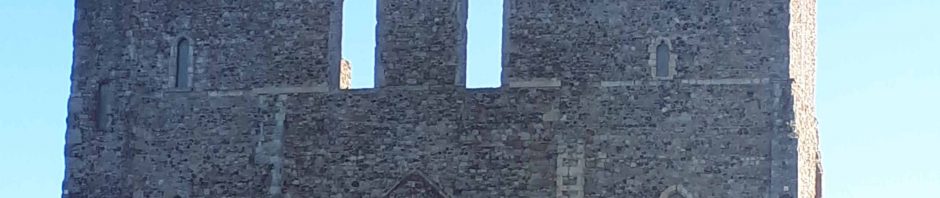
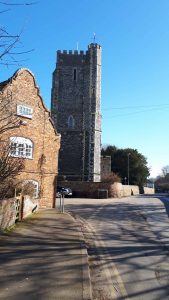
After using the public toilet facilities (always a bonus to have these) and of course paying for parking we headed towards the church. There’s not much left of the church apart from the twin towers, which were added in the 12th century, and these are visible almost throughout the walk as a landmark.
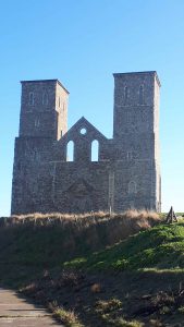
It was quite busy with people at the church looking at the ruins, and also lots of cyclists travelling the same way as us along the sea wall. After a short time we managed to escape the crowds and get on our way. As we walked along the sea wall, to the right there is lots of marshland and open fields, and to the left it heads out towards the North Sea. On Sunday the sea was amazingly still, like a millpond.
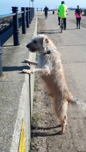
We continued along the sea wall for the best part of 2 miles heading towards Birchington, Westgate, Ramsgate and Margate. Paco enjoyed having a good look over the wall and at one point decided that it would be a good idea to jump over and run along the beach. What he soon realised was the wall got taller and he panicked a bit when he realised he couldn’t get back over to us. Barking madly at us he managed he realised he had to run further up the beach where he was then able to jump back over to join us.
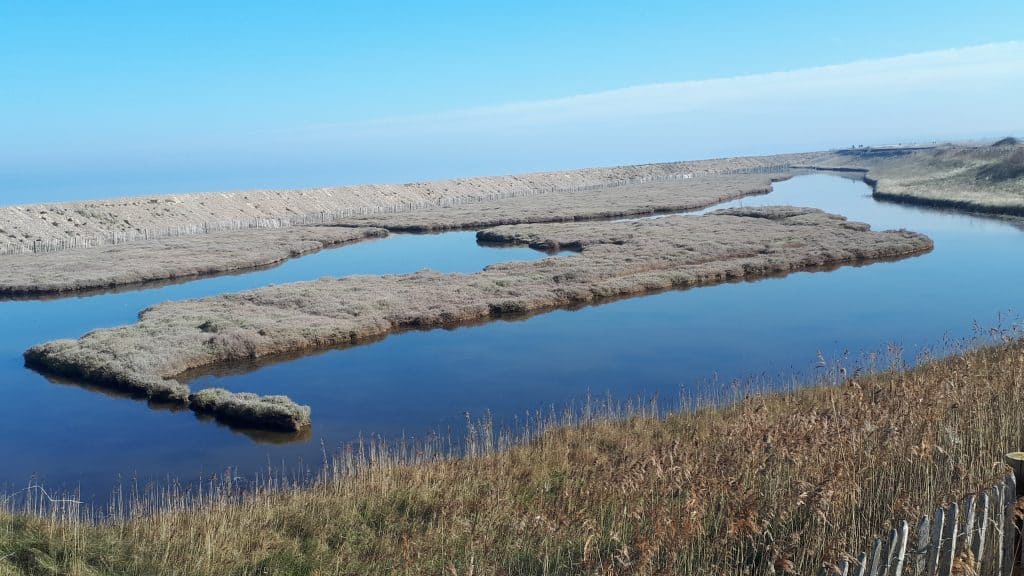
We came across a lagoon as you can see in the photo here, and as we got past it we turned right to follow the sign for the Viking Coastal Trail. We followed the bank of the dyke, where plenty of anglers were fishing in amongst the reeds. It wasn’t long before we came to a railway crossing, where for safety sake we carried Paco over the crossing, making sure no trains were coming. After this we walked along the concrete path until we reached the farm at Chambers Wall.
Walking past a few houses as we walked up the hill, we reached Potten Street at the top then turned right. This led us to a bridge which crosses the Thanet Way. Of course it was quite steep – the steepest part of the walk. As we went over the bridge (feeling a bit anxious) we saw on the other side of the Thanet Way a solar farm. Carrying on we soon arrived in the village of St. Nicholas at Wade. This was such a lovely little village – a great church, and 2 pubs opposite each other. One was the Sun Inn and the other was The Bell, which I understand is well known locally for its great food. Must remember that next time we come back.
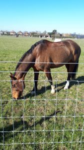
As we reach the village Post Office we turned right opposite this. The road bears left but we went straight on past a lovely looking timbered cottage, up an alleyway which leads to the recreation ground. Keeping to the left of this the footpath goes through a field. Keep on a tarmac path passing horses in a field, then a few houses, and then we descended through the middle of the field following the tarmac path. We met a couple of guys with Alsatians who weren’t too keen on Paco invading their territory but he skirted round pretty quickly.
At the bottom is a kissing gate but instead of going through that we turned right and walked along the bridleway, with many hoof marks showing the way. This runs alongside a hedge and dyke. We got to a farm where we crossed over the bridge, and past a whole lot of caravans – we couldn’t work out if they were for hire of for the farm workers. Then we followed the path ahead till we came across a cottage.
Turning right past the back of the house, then through a gate. Hunger had got the better of us by then, and so out came our sandwiches and drinks as we walked up the concrete path. Paco liked the odd tidbits that we threw for him – I think that is a big part of our walks with him. The path was called Snake Drove, which was a little bit worrying.
The long path took a couple of right angles, and eventually the concrete path ends. It continues along the edge of fields, but as usual when we go on a walk for the first time we went wrong, and we think it was at this point. This was the Wantsum Walk – well, it should have been, anyway.
We crossed a bridge over a dyke, walked alongside it, and this was where we saw some swans, one of which decided to hiss at Paco after he went to say hello. I think he was a bit taken aback, but he soon came running back to us when we called him.
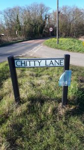
We continued to follow the dyke until we reached the end, and soon came out at a road junction. We saw a road sign saying Chitty Lane, and it was soon we realised we were in the village of Boyden Gate. A quick look on Google Maps and I realised we were about a mile or so from where we should have come out.
Turning right into North Stream we were soon back on track. This road passes a famous pub called the Hog and Donkey. We were actually stopped by a couple in a car, who were looking for the pub but as it turns out they had already passed it. However, I think the reason they didn’t see it was because it looks like it has shut down now and is a private residence.
We followed this road and after a short while came across another bridge over the Thanet Way, and at Chislet Mill we crossed over the road to a concrete track. Straight down towards the railway line, which we passed underneath, then over a wooden style and followed the dyke back towards the caravan park in Reculver.
By this time the children’s play park was very busy with the unusual sunny weather, so getting our coffees in the cafe seemed to take forever. Once we had them we were soon heading back towards home.
This was a lovely walk which according to the guide book should have been 9 1/2 miles but I think it was nearer 11 with the part that we went wrong.
The Wantsum Walk
The Wantsum Walk is almost 25 miles in length, stretching from Herne Bay out to Birchington. The first part starts in Herne Bay at Central Parade and follows the coast before heading inland at Bishopstone. Pass through Hillborough and cross the Thanet Way at Hawthorn Corner before heading to Highstead.
Here you head over fields in 3 sides of a square, before getting back on road at Chislet. At Upstreet you cross over the Ashford to Ramsgate railway line, follow the Great Stour river before head back over the railway and onto the village of Sarre.
Here you head to the Thanet Way again, crossing over 3 times, the last just after St Nicholas-at-Wade, and back the way we came on our walk. You’ll get back to the coast just before Minnis Bay, along the coast a short way before finishing slightly inland at Birchington-on–Sea.
Recent Posts
The Role of Protein in Walking Endurance: Effects, Needs, and Strategies
If you walk regularly - whether that’s parkrun, brisk fitness walks, or longer weekend hikes - protein plays a key role in how well you recover, adapt, and improve. Walking might not feel as...
The Ultralight Transition: Is It Worth It for UK Day Hikers?
There is a quiet revolution happening on Britain’s footpaths. If you’ve spent any time walking the ridges of the Peak District, tracking the dramatic coastal paths of Cornwall, or winding along...