

Table of Contents
Some links on posts are affiliate links and will earn us a commission from qualifying purchases
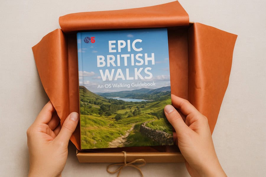
When it comes to gifts to give hiking enthusiasts it’s so hard to choose something that either they haven’t already bought themself, or that you don’t know what they actually need. So rather than buy a gift that will not be used, why not inspire them with a book which will give them some dream destinations for their next hiking adventure.
Let’s take a look at these great books from Ordnance Survey – who better to know the best places to hike?
100 Outstanding British Walks
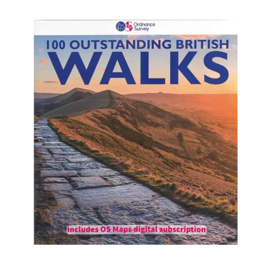
The 100 Outstanding British Walks collection from Ordnance Survey brings together some of the most beautiful and rewarding walks from across the UK. With routes suitable for all experience levels – from leisurely strolls and half-day rambles to full-day hikes – the book offers a total of 625 miles of walking inspiration. It’s ideal for anyone looking to explore new areas, whether you’re new to country walking or an experienced rambler seeking your next adventure.
Each walk is also available in OS Maps online, so you can follow the routes on your mobile device or print them before heading out. Alongside detailed maps and directions, the book features engaging background information about each region and stunning photography that captures the essence of Britain’s varied landscapes.
As a bonus, the book includes six months of OS Maps Premium access, unlocking all 607 Leisure maps. This allows you to discover thousands of additional routes shared by other walkers or create your own personalised adventures. Activation is simple – just use the unique code printed inside the back cover.
South-West England
- 1: Wistman’s Wood – 7.2km (4.5m)
- 2: Rippon Tor, Pil Tor and Buckland Beacon – 10.3km (6.5m)
- 3: Lynton and Valley of Rocks – 8.8km (5.5m)
- 4: Simonsbath and the River Barle – 12.1km (7.5m)
- 5: Hurlstone and Selworthy Beacon – 10.1km (6.25m)
- 6: Helford, Little Dennis and Manaccan – 8km (5m)
- 7: Tollard Royal and Win Green – 11.3km (7m)
- 8: Corfe Castle and the Purbeck Ridge – 9.7km (6m)
- 9: Beer and Branscombe – 9.9km (6.25m)
- 10: Cheddar Gorge and Velvet Bottom – 10.5km (6.5m)
- 11: Baggy Point and Saunton Down – 11.4km (7.25m)
- 12: Wills Neck and Triscombe Combe – 10.5km (6.5m)
- 13: Kingston and the River Erme – 9.1km (5.75m)
- 14: Cotehele – 5.6km (3.5m)
- 15: Around St Agnes – 10km (6.25m)
- 16: Golden Cap – 10.5km (6.5m)
- 17: Bath and Claverton Down – 13.5km (8.5m)
- 18: Avebury, West Kennett and Silbury Hill – 10.5km (6.5m)
- 19: Stonehenge – 12.9km (8m)
South-east England
- 20: New Forest Snapshot – 4.5km (2.75m)
- 21: Around Burley – 6.8km (4.25m)
- 22: Firle Beacon and Charleston Farmhouse – 8km (5m)
- 23: Friston Forest, the Seven Sisters and Cuckmere Haven – 10.5km (6.5m)
- 24: Cissbury and Chanctonbury Rings – 17.6km (11m)
- 25: The Chidham Peninsula – 8km (5m)
- 26: Ibstone, Turville and Fingest – 12.3km (7.75m)
- 27: Albury, Ivinghoe Beacon and Ashridge – 11.8km (7.5m)
- 28: Cranbrook and Sissinghurst – 11.6km (7.25m)
- 29: Freshwater and Tennyson Down – 6km (3.75m)
- 30: Wye and Crundale Downs – 13.5km (8.5m)
- 31: Albury Downs and St Martha’s Hill – 11.2km (7m)
- 32A: Whitehall – 1.4km (0.75m)
- 32B: St James’s – 3.2km (2m)
Heart of England
- 33: Shugborough Park and Sherbrook Valley – 12km (7.5m)
- 34: Wotton-under-Edge and the Tyndale Monument – 6.5km (4m)
- 35: Bourton-on-the-Water, the Slaughters and Naunton – 16km (10m)
- 36: Great Malvern and the Worestershire Beacon – 8.9km (5.5m)
- 37: Corvedale and Wenlock Edge – 10.9km (6.75m)
- 38: Caer Caradoc and Cardington – 11.6km (7.25m)
- 39: Goodrich Castle – 13.3km (8.25m)
- 40: Blenheim Park – 10.5km (6.5m)
- 41: Ironbridge World Heritage Site – 11.6km (7.25m)
- 42: Cromford and Matlock Bath – 11.3km (7m)
East England
- 43: Horsey – 6km (3.75m)
- 44: River Bure and Upton Marshes – 9.7km (6m)
- 45: The Weavers’ Way to The Berney Arms – 14.5km (9m)
- 46: Constable Country – Flatford and East Bergholt – 8.9km (5.5m)
- 47: Walesby, Claxby and Normanby le Wold – 8.4km (5.25m)
- 48: Castle Rising – 3.6km (2.25m)
- 49: West Runton and Beacon Hill – 11.7km (7.25m)
- 50: Dunwich Heath and Minsmere Marsh – 8km (5m)
North of England
- 51: Elterwater – 8.9km (5.5m)
- 52: Wray Castle and Blelham Tarn – 9.7km (6m)
- 53: Crummock Water – 13.8km (8.5m)
- 54: Kielder Water and the Bull Crag Peninsula – 10.1km (6.25m)
- 55: Hartside, Salter’s Road and High Cantle – 13.7km (8.5m)
- 56: Farndale – 5.6km (3.5m)
- 57: The Cook Monument and Roseberry Topping – 10.5km (6.5m)
- 58: Robin Hood’s Bay and Ravenscar – 14.5km (9m)
- 59: Stanage Edge and Higger Tor – 5.6km (3.5m)
- 60: Lose Hill – 9.7km (6m)
- 61: The Manifold Valley – 10.5km (6.5m)
- 62: Malham Cove, Gordale Scar and Janet’s Foss – 8km (5m)
- 63: Pen-y-ghent – 9.5km (6m)
- 64: Gunnerside, Kisdon and Muker – 18km (11.25m)
- 65: Leighton Moss – 7.3km (4.5m)
- 66: Kirkham Priory and the River Derwent – 7.6km (4.75m)
- 67: High Cup Nick – 12.9km (8m)
- 68: How Stean Gorge and Upper Nidderdale – 7km (4.25m)
- 69: Craster and Dunstanburgh Castle – 7.6km (4.75m)
- 70: Fountains Abbey – 9.3km (5.75m)
- 71: Durham – Riverside and Woods – 8km (5m)
- 72: Hadrian’s Wall at Walton and Thirlwall Castle – 12.5km (7.75m)
Wales
- 73: Llyn y Fan Fach and the Carmarthen Fans – 9.7km (6m)
- 74: Waterfalls Walk – 14.5km (9m)
- 75: Brecon Beacons Horseshoe – 13.7km (8.5m)
- 76: Porthgain and Abereiddi – 5.6km (3.5m)
- 77: St David’s, Porth Clais and Ramsey Sound – 14km (9m)
- 78: Precipice Walk – 5.5km (3.5m)
- 79: Conwy Mountain and Sychnant Pass – 9.5km (6m)
- 80: Cnicht – 10.7km (6.75m)
- 81: Moel Famau – 8.25km (5.25m)
- 82: Llanmadoc Hill – 10.5km (6.5m)
- 83: Aberdaron and Land’s End – 12km (7.5m)
- 84: Wynford Vaughan Thomas’ Viewpoint – 9.7km (6m)
- 85: Ty Mawr and the Pontcysyllte Aqueduct – 9km (5.5m)
- 86: Saundersfoot and Tenby – 6.5km (4m)
Scotland
- 87: Glen Feshie – 5.5km (3.5m)
- 88: The Lily Loch and Loch an Eileen from Inverdruie – 9.7km (6m)
- 89: Morrone – 11.3km (7m)
- 90: Lochnagar and Loch Muick – 22.4km (14m)
- 91: Lochgoilhead and Donich Water – 4km (2.5m)
- 92: Ben Lomond – 11.7km (7.25m)
- 93: Ben Venue – 13.3km (8.25m)
- 94: Pap of Glencoe – 8km (5m)
- 95: Isle of Iona – 13.7km (8.5m)
- 96: Dunkeld, The Hermitage and Birnam – 12.4km (7.75m)
- 97: Camasunary-Elgol-Glasnakille – 18km (11.25m)
- 98: The Quiraing and Meall na Suiramach – 6.5km (4m)
- 99: Rascarrel Bay and Balcary Point – 8km (5m)
- 100A: Grassmarket and Greyfriars – 2.3km (1.5m)
- 100B: Georgian New Town – 4.7km (2.75m)
Epic British Walks
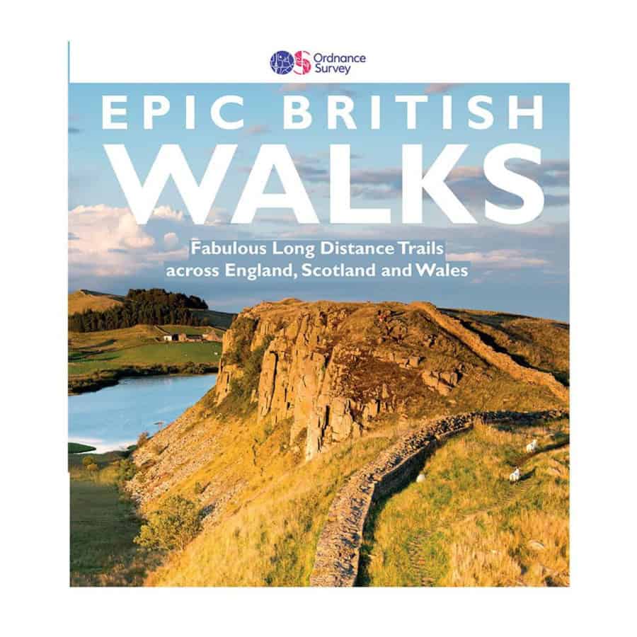
OS Epic British Walks is a superb introduction to long-distance walking, featuring 38 incredible trails that showcase the stunning variety of Britain’s landscapes. Each route is graded by difficulty, offering something for everyone – from beginners tackling their first multi-day walk to experienced hikers seeking a real challenge. Together, these trails span over 5,000 miles across the UK.
The book takes you through some of the country’s most breathtaking areas, including National Parks, Areas of Outstanding Natural Beauty, National Scenic Areas, and even UNESCO World Heritage Sites. Whether you prefer dramatic coastlines or peaceful countryside, there’s an adventure waiting for you.
Ideal for planning your next walking holiday, hiking break, or weekend escape, the guide provides detailed introductions to each route, suggested itineraries, and key highlights not to miss along the way. It also lists the Ordnance Survey maps you’ll need to navigate each trail confidently.
- Features 38 epic long-distance walks across England, Scotland, and Wales
- Covers over 5,000 miles of inspirational routes through National Parks, Areas of Outstanding Natural Beauty, UNESCO World Heritage Sites, and more
- Includes walks for everyone – from first-time hikers to ultra-fit adventurers and seasoned ramblers
- Showcases breathtaking photography that captures the unique character of each trail
- Highlights both famous National Trails and lesser-known regional long-distance paths
- Provides full end-to-end itineraries with daily stage breakdowns
- Offers practical route-planning tips, including advice on public transport, accommodation, and camping options
- Lists the relevant OS Explorer and Landranger map sheet numbers for every walk
Outstanding Walks Scotland
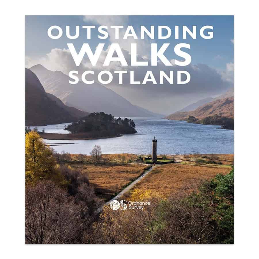
Outstanding Walks Scotland is a beautifully crafted guide celebrating the very best of Scotland’s landscapes, history, and culture. Inside, you’ll find 60 handpicked walks, 48 must-see sites, and 42 photographic essay locations – more than 300 inspiring places to explore. The book combines practical route details with stunning imagery, offering the perfect balance of information and inspiration for planning unforgettable Scottish adventures.
From short strolls and half-day rambles to full-day hikes (including five Munro ascents), the routes span the length and breadth of Scotland – from Shetland’s rugged Eshaness cliffs to the Mull of Galloway’s southern tip, and from the Outer Hebrides to the Aberdeenshire coast. Whether you’re a casual walker, family explorer, or seasoned rambler, this collection offers something for everyone. A six-month OS Maps digital subscription is also included, allowing you to access all the featured routes and navigate confidently via your phone or printed maps.
Key features include:
- 60 carefully selected routes showcasing Scotland’s most scenic landscapes
- A mix of short walks, half-day rambles, and full-day hikes for all abilities
- 315 miles of exceptional walking across 60 top destinations
- 48 “Don’t Miss” sites of natural beauty, historical interest, and cultural significance
- 42 picture-essay images to inspire your next Scottish journey
- Practical route planning with OS Explorer map sheet numbers for every walk
- QR codes linking directly to routes in the OS Maps App
- Lavish photography – 350 images and 40,000 words of expert insight
- Written by respected outdoor writer and photographer Felicity Martin, based in the heart of Scotland
Outstanding Walks Lake District
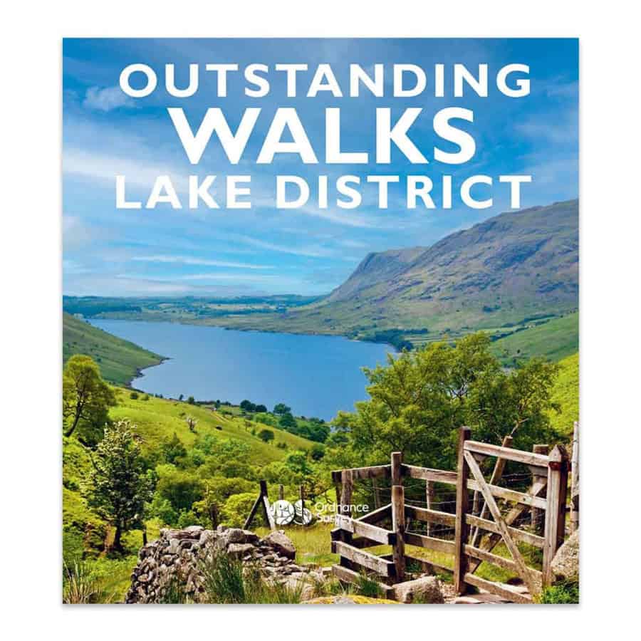
Outstanding Walks Lake District is a stunning celebration of Britain’s most visited National Park. Featuring over 300 beautiful locations – including 60 unforgettable walks and 48 must-see sites – this book is an essential companion for anyone planning a trip to the Lakes. It combines inspiring photography with practical details, making it perfect for both day trips and longer holidays exploring the region’s breathtaking scenery.
The routes span the entire Lake District, from the charming South Lakes – home to Cartmel, Coniston, and Beatrix Potter’s Hill Top – to the rugged peaks of the Central and Western Lakes, where you’ll find Langdale, Scafell Pike, and Haystacks. The North-West Lakes chapter features famous viewpoints such as Cat Bells and Skiddaw, while the Ullswater and Haweswater sections include both gentle paths to Aira Force and challenging ascents like Helvellyn via Striding Edge. Northern and Eastern Cumbria also feature, offering diverse landscapes and historic towns like Carlisle and Appleby-in-Westmorland.
Key features include:
- 60 inspiring walks covering 325 miles across the Lake District and Cumbria
- A mix of 27 short walks (up to 3 hours), 18 half-day rambles, and 15 full-day hikes – including Scafell Pike, England’s highest peak
- Routes suitable for beginners, families, and experienced hikers alike
- 48 “Don’t Miss” sites showcasing stunning views, heritage landmarks, and natural wonders
- 42 “Picture Perfect” scenes designed to inspire your next adventure
- 60 walk overview maps and 7 detailed regional maps
- Beautifully illustrated with 350 captivating photographs
- QR codes linking each walk to OS Maps for easy smartphone navigation
So there you have it, 4 of the very best inspirational books you could buy for your beloved hiking enthusiast. Get ready to be thanked for letting them select their next adventure. These are gifts that will certainly be treasured for a lifetime – and if you are lucky you may well be invited along too!
Recent Posts
Salomon X Ultra 4 Mid GTX vs Hoka Anacapa 2 Mid GTX: Which Should You Choose?
If you are gearing up for a season of bagging Wainwrights in the Lake District or tackling the rugged coastal paths of Cornwall, finding the right footwear is absolutely paramount. The UK hiking...
Best 2-Day Walks in South East England: The Ultimate Weekend Guide
Are you looking for 2-day walks in South East England, perfect for a weekend escape with some gentle exercise thrown in? For many, "South East England" conjures images of rolling hills, sleepy...